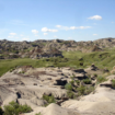
A look at the 1-in-100-year flood mapping for Medicine Hat's Flats (top) and downtown areas. The maps do not take into account the nearly 7 km in berms the city has had built since 2013.--IMAGE FROM GOVERNMENT OF ALBERTA
cgallant@medicinehatnews.com@CollinGallant
Hatters can see the potential effects of up to a 1-in-1,000-year flood in a new provincial flood mapping study, but harder to discern are the effects of berms built by the city since major flooding in 2013.
Myriad flooding scenarios and even the migrating paths of creeks and the South Saskatchewan River over time are outlined in the new study, open now for public feedback from Alberta Parks and Environment.
However, local officials are stressing that maps, which show large portions of the community still flooding during even a relatively typical flood, use a technical process based on bare geography, not including man-made mitigation like berms, or the effects of dams controlling river flows.
“When it’s for technical purposes, engineers can wade through it, but if it’s intended for public, we’d like to see more clarity,” said Dwight Brown, general manager of the municipal works department, as the issue arose at Wednesday’s infrastructure committee meeting.
The study and local maps are part of a two-year effort by the province to map flood risk in 60 municipalities across Alberta, including Medicine Hat.
They show how the South Saskatchewan River would react in a variety of flood scenarios, but categorizes them in typical fashion related to probability (such as “1-in-100-year” events), when city planners rely on actual flow levels that don’t align with the study’s classifications.
Essentially they are two sets of the same figures, according to planning staff, who assured council members the report doesn’t raise questions about the berm network.
“It doesn’t affect any of the GIS (mapping work) we’ve done,” said Brown.
The study is open now for public feedback until Jan. 15 and is available on the ministry’s website.
City engineers reviewed the initial findings last year and provided feedback at that time.
“There’s not a significant amount of change from the flood maps that were drawn up 34 years ago,” said Carlie Collier, the city engineer who led the berming program that began following the 2013 floods.
“The 1-in-100-year (scenario, the most common significant event) has very similar inundation maps, and that gives us a clear picture of water levels we could expect should flooding occur.”
The maps consider “natural flow,” essentially bare volumes of water as if the river was unimpeded, whereas the “regulated flow” is used by local flood planners, said Collier.
The outline of a one-in-200-year event in the study closely resembles initial predictions of the 2013 flood, which predicted water rising to Third Street in Riverside and down S. Railway Street next to the city centre. It assumed a flow rate in the river above 6,000 cubic metres per second, though in 2013 the actual peak rose just above 5,200 as volumes were released. Even then and with temporary berms in place more than 500 homes were badly damaged.
Since 2013, the city has built nearly seven kilometres of flood protection measures at a total cost of more than $30 million, including grant funding from the province and Ottawa. This year could see the completion of final major portions on berms in Harlow and near Industrial Avenue.
City engineers used that 1-in-200-year level as the target elevation in the berm, including building most areas up one metre above that level.
The province is hoping to finalize 21 separate flood plans for at-risk communities by the end of 2021.
The once in a millennium event in Medicine Hat would swamp most of the river valley, the contours of which were initially formed by floods over tens of thousands of years.
Essentially, the local flood plain through Medicine Hat would be under water, including Riverside, everything to the base of the Southeast Hill, as well as the city’s main power plant, water treatment plant and sewage treatment plant.
Along with the severe flooding, those expected to occur just once in a 350, 500, 750 or 1,000-year time frame, there are eight separate maps for lower level events ranging between a typical year to the 1-in-75-year event.
In the local region, the map’s area includes 45 kilometres of the South Saskatchewan River through Medicine Hat and outlaying areas, as well as the Ross, Seven Persons and Bullshead creeks, including areas of Cypress County and the hamlet of Desert Blume.